Documenting Excavated Features
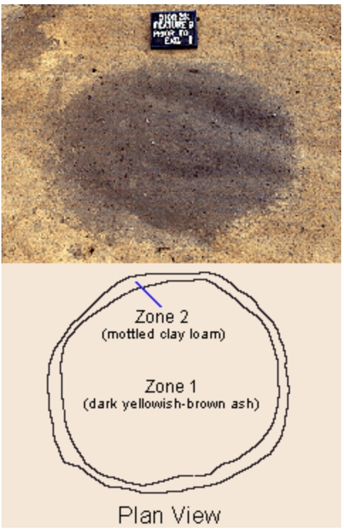
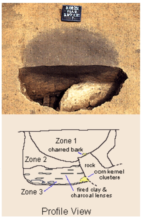
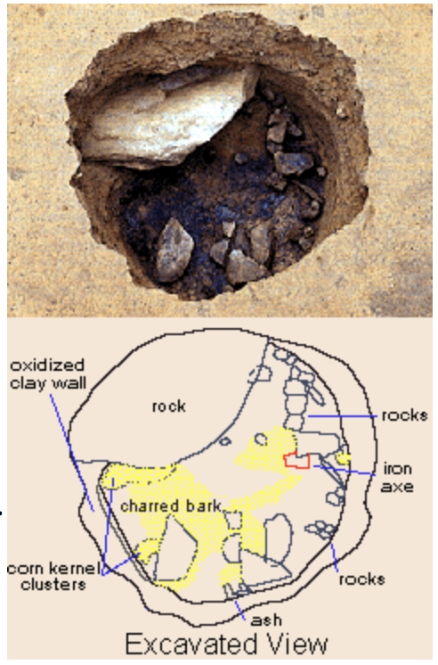
All pits are carefully drawn and photographed as they are excavated. Three kinds of drawings are usually made. A plan view depicts the outline of the feature as seen from above. A profile view depicts the feature in cross section, as if seen from the side. And the excavated view shows the contents of the feature after excavation has been completed. By clicking on the links below, you can see a sequence of photographs showing a pit feature at different stages of excavation and the drawings that were made at each stage.
Before excavation - a photograph and map of an unexcavated archaeological feature at Occaneechi Town
During excavation - a photograph and map of an unexcavated archaeological feature at Occaneechi Town
After excavation - a photograph and drawing of the feature after excavation has been completed
Last updated